 ObjectExplorer
Maps
GeoJSON geojson topojson, GPS tracks gpx tcx igc, Google Earth kml kmz, shapefiles shp shx, GeoPackage gpkg, map tiles mbtiles pmtiles, FlatGeobuf fgb, MapInfo mif, OpenStreetMap osm osm.pbf, GML gml, and GeoParquet
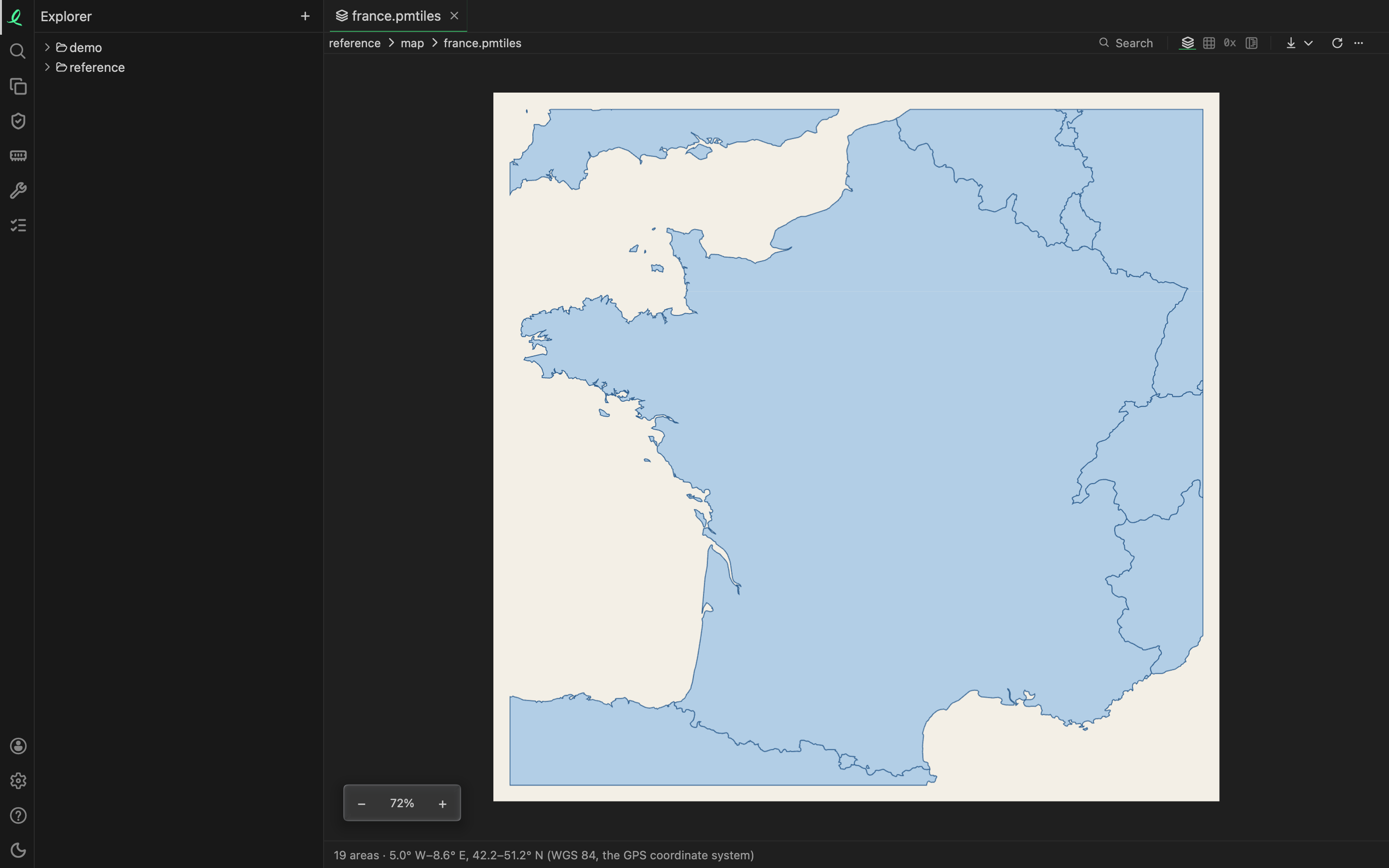
A map file opens as its shapes, drawn: points, lines and areas, at the file's own coordinates. No map service is called and nothing is fetched to draw under them; what you see is what the file holds. − and + zoom in and out.
The line at the pane's foot says what the map holds and where — "19 areas · 5.0° W–8.6° E, 42.2–51.2° N (WGS 84, the GPS coordinate system)". A map in a projection of its own says its coordinates are in the file's own units. In a narrow pane the counts stay and the rest is in the line's tooltip.
The text of the ones written as text is a click away.
Shapes
| File | What is drawn |
|---|---|
GeoJSON geojson, TopoJSON topojson | its features |
a GPS track gpx | its tracks, routes and waypoints |
Google Earth's KML kml, zipped kmz | its placemarks |
a shapefile shp, or its index shx | its shapes |
A shapefile's .shp is drawn on its own, and its .shx draws the .shp beside it. The attributes in the .dbf open as a table.
Maps that are tables too
These open on their map, and their features are rows next, on the Table and in the notebook, a geometry written as text (WKT, the well-known text of geometry):
| File | A row for each |
|---|---|
FlatGeobuf fgb | feature, with its properties |
MapInfo interchange mif, its attributes in the .mid | object, with its attributes |
OpenStreetMap extract osm.pbf, or its XML osm | node, way or relation: three tables |
GML (Geography Markup Language) gml | feature, a column a property |
GeoParquet, a .parquet holding geometries | row, as any Parquet file's |
Garmin's Training Center XML (TCX) activity tcx | track point: time, place, heart rate, speed |
a glider's flight log, the International Gliding Commission's igc | fix: time, place, both altitudes |
A GeoParquet file is a Parquet file whose footer says which columns are geometries: it opens on its map, where any other Parquet file opens on its table. An OpenStreetMap extract draws its ways through their nodes; its nodes, ways and relations are three tables, their tags a JSON column the grid splits into a column per key. A MapInfo .mid opened alone is its text.
A Garmin FIT activity opens on its track the same way, its messages as tables next — see health and fitness.
Databases of maps
A GeoPackage (.gpkg) and an MBTiles tileset (.mbtiles) are SQLite files: each opens on its map first, then the list of its tables, as any SQLite file, each table queryable with SQL. A GeoPackage's geometries read as text in its tables.
Map tiles — an MBTiles tileset or a PMTiles archive (.pmtiles) — are drawn in Web Mercator, the projection tiles are cut in, at the deepest zoom level of at most 16 tiles, so the map shows the most detail a picture holds. A vector tile's points, lines and areas are drawn as shapes, a picture tile (PNG, JPEG, WebP) as the picture where it lies. A PMTiles archive's Structure lays out its header, its directories, its metadata and its tiles.
Next: images.